Rural Innovation
Solar Drones Help Monitor Wildfires in Real-Time
A remote-controlled drone fleet launched in western NSW is giving firefighters a vital new tool to track bushfires with live infrared feeds and early smoke detection capabilities.
2025-06-14 • By Rowan Thorne
When fires rage across Australia’s bushland, speed is everything. Now, a fleet of solar-powered drones is giving fire crews a crucial edge, scanning vast terrain in real time and detecting hotspots before flames grow out of control.
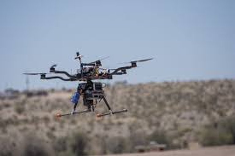
Developed by a Brisbane-based tech startup in partnership with the Rural Fire Service, the drones use thermal imaging and GPS to map fire fronts and locate at-risk zones — even in thick smoke.
'We can launch within minutes, and the data comes in live,' explains RFS coordinator Neil Jacobs. 'It’s like having a fire spotter in the sky 24/7, without putting anyone in danger.'
Unlike traditional surveillance aircraft, the drones are lightweight, fully electric, and can be deployed in swarms to cover large areas. Solar panels allow them to recharge at base stations in the field, dramatically extending their operating time.
Firefighters say the technology is already making a difference. During a recent flare-up near Dubbo, drone footage identified a new fire line moving toward homes — prompting evacuations that likely saved lives.
As climate change increases fire frequency and intensity, officials see these drones as a vital new tool. Expansion plans are underway to equip more brigades across NSW and Queensland with similar systems before the next fire season.